
 While NOAA and NASA haven't made official pronouncements yet, 2012 is looking like a climate change-fueled record-smasher for America's hottest year ever. As you'd expect, cities across the country broke local records for hottest year ever, with MetroWest Daily News' Rob Haneisen detailing 2012's extreme weather in Massachusetts - not only on record temperatures, but drought and strong storms:
For Boston, statistical highlights were that it was the second warmest winter on record and the warmest spring on record. These records go back to 1878. The average mean temperature for the year was 2.8 degrees above normal; rainfall was 7.04 inches below normal and snowfall - not surprisingly - was 31.7 inches below normal. Winter and spring also had average mean temperatures of 5.4 and 5.3 degrees above normal.Hartford also broke its record for warmest year on record, with Providence coming in at 2nd-warmest. But as Elizabeth Harball of E&E News reports, The Queen City takes the cake: "The biggest record jump occurred in Burlington, Vt., which had an average temperature of 50 degrees in 2012, exceeding the site's previous high, set in 1998, by 1.6 degrees." That's not 1.6 degrees above average, or breaking a single-day's record by 1.6 degrees - the average temperature for an entire year was nearly two degrees higher than any previous year on record. Amazing.
For Worcester, statistical highlights were that it was the second warmest winter and the warmest spring on record. The average mean temperature for the year was 3.4 degrees above normal; rainfall was 4.19 inches below normal and snowfall was 14.4 inches below normal. Winter and spring also had average mean temperatures of 6.0 and 5.6 degrees above normal.
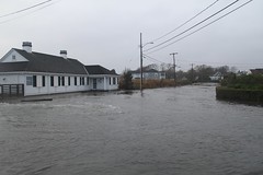
2012 was also an above-normal season for tropical storms with 19 named storms (average is 12) and 10 hurricanes (average is 6). Here's a link to a wrap-up of the Atlantic tropical season from NOAA. Our most notably entry is post-tropical cyclone Sandy this year - the second consecutive year of a devatasting cyclone affecting New England (Irene was 2011's entry).
And New Scientist warns that because global warming is melting Arctic sea ice, 2013 could see even more extreme weather:
Predictions that a major El Niño warming event - and the coming solar maximum - would help make next year the warmest on record now seem wide of the mark. All eyes will probably be on the Arctic instead. Some say the record loss of sea ice in summer 2012 was a one-off, others that it was the start of a runaway collapse. If the latter, summer sea ice could virtually disappear as early as 2016. What is certain is that the ice reforming now will be the thinnest on record, priming it for destruction next summer. [...]Learn more about how global warming is fueling extreme weather.
Research in 2012 implicated the fast-warming Arctic in a slowing of the jet stream. This is bringing extreme weather to mid-latitudes, including prolonged cold spells in Europe, Russia's 2010 heatwave, and record droughts in the US in 2011 and 2012. Watch out for more weird weather in 2013.
No comments:
Post a Comment